

Singapore Local Food
Try the Best Hawker Centres
Singapore has an unparalleled culinary scene. At the heart of this delicious mecca lies the humble yet mighty hawker centre – a vibrant, open-air food complex where you can savour authentic Singaporean flavours at wallet-friendly prices. But navigating the sheer variety of options can be daunting. That's why I've put together this guide to some of Singapore's most renowned hawker centres, highlighting the must-try dishes and providing you with all the essential details to plan your own hawker adventure
Best Hawker Centres in Singapore
Lau Pa Sat


🔵 Must-Try Food: Satay
Imagine succulent skewers of marinated meat (chicken, beef, or mutton) grilled to perfection over charcoal, imparting a smoky aroma and flavour. These are served with a rich and chunky peanut dipping sauce, along with refreshing cubes of raw onions, cucumbers, and ketupat (compressed rice cakes). The sweet and savoury glaze on the satay combined with the nutty sauce is an explosion of flavour. Elevation: Generally low, with some gentle inclines and declines on the longer trails. The highest point is the Jelutong Tower, offering panoramic views (requires climbing stairs).
🔵 Stall Spotlight: Numerous Satay Stalls (Look for those with long queues!)
🔵 What to Order: Mixed Satay (at least 10-20 skewers to share!), Peanut Sauce, Ketupat
🔵 Price Range: $0.80 - $1.20 per skewer
🔵 How to Get There: Raffles Place (East-West & North-South Lines), Telok Ayer (Downtown Line)
🔵 Opening Hours: Generally, most stalls are open from late afternoon/evening until late night. Some stalls might have lunch service. It's best to check individual stall timings.
🔵 Points of Interest: The architecture itself is worth admiring. The atmosphere is particularly vibrant in the evenings when Boon Tat Street is closed to traffic and transforms into "Satay Street."


Satay skewers
House in a Victorian-designed building
Sungei Buloh Wetland Reserve: A Haven for Bird Lovers
🔵 How to Get There: Take the North-South Line (NSL) to Kranji MRT Station (NS7). From the bus stop opposite Kranji MRT station, take bus service 925 (check for specific "Sungei Buloh Wetland Reserve" signs, as there are two routes for 925) and alight directly at the reserve's entrance.
🔵 Elevation: Generally flat, with boardwalks and well-maintained paths.
🔵 Difficulty: Moderate to strenuous, depending on the chosen trail. The main road is a continuous uphill climb. The forest trails can be uneven and challenging. Hindhede and Dairy Farm offer easier options.
🔵 Trail Options & Length: Primarily one main paved road leading to the summit, with several steeper, more rugged trails branching off:
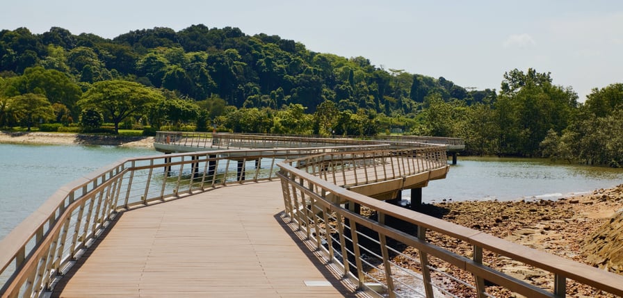
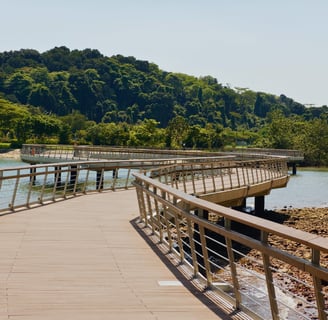
Main Bridge & Wetland Centre Trail (approx. 1.3 km): An accessible boardwalk leading to the Wetland Centre, perfect for observing migratory birds during their season (September to March).
Migratory Bird Trail (approx. 1.9 km): Takes you closer to the mudflats and bird hides.
Coastal Trail (approx. 2 km): Offers views of the Johor Straits and the surrounding mangrove ecosystem.
🔵 Facilities: Visitor centre with information and exhibits, toilets, water fountains, bird hides equipped with viewing slots, and observation towers.
🔵 Points of Interest: A crucial stopover for migratory birds on the East Asian-Australasian Flyway, diverse mangrove ecosystem with mudskippers, crabs, and other intertidal creatures, observation hides for close-up birdwatching, and scenic coastal views..
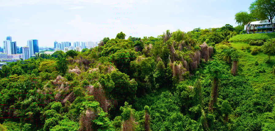
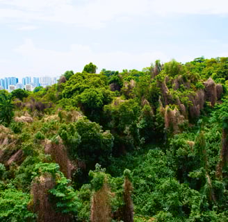
Bukit Timah Nature Reserve: Conquer Singapore's Highest Hill
🔵 How to Get There: By MRT - Take the Downtown Line (DTL) to Beauty World MRT Station (DT5). The reserve's main entrance is a short 10-minute walk from the station along Hindhede Drive.
By Bus - Various bus services stop along Upper Bukit Timah Road near the Beauty World Centre. From there, it's a short walk to Hindhede Drive.
🔵 Elevation: The highest natural point in Singapore at 163.63 meters. Significant elevation gain on the main road and some of the forest trails
🔵 Difficulty: Moderate to strenuous, depending on the chosen trail. The main road is a continuous uphill climb. The forest trails can be uneven and challenging. Hindhede and Dairy Farm offer easier options.
🔵 Trail Options & Length: Primarily one main paved road leading to the summit, with several steeper, more rugged trails branching off:
Main Road (approx. 1.6 km to the summit): A relatively steep but paved road suitable for a good workout.
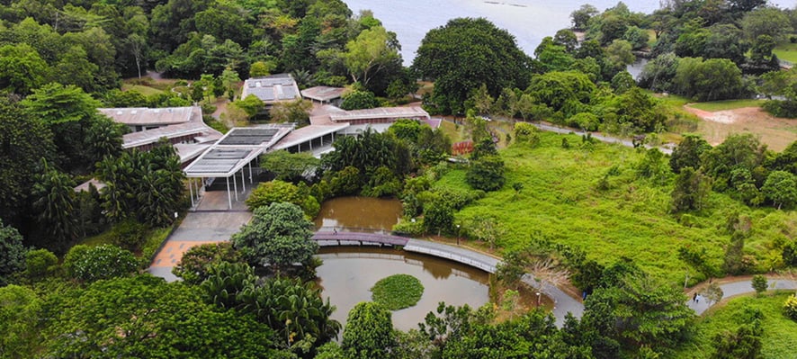
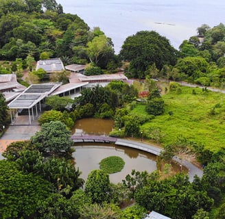
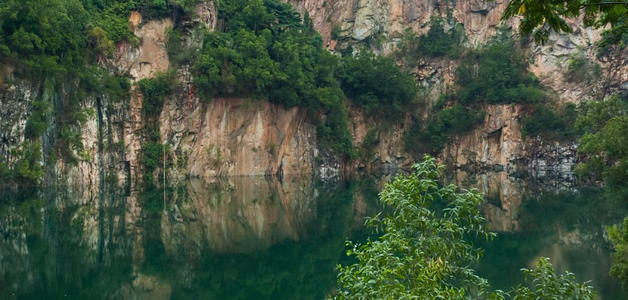
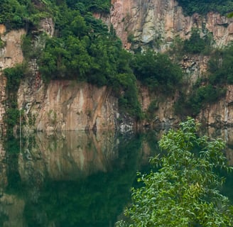
Hindhede Nature Park Trails (various short loops): Located at the base of Bukit Timah Hill, offering gentler walks around a quarry lake.
Dairy Farm Nature Park Trails (various loops): Connected to Bukit Timah, offering diverse landscapes including a former dairy farm and a quarry.
🔵 Facilities: Visitor centre with information and exhibits, toilets, water fountains, shelters at the summit and along some trails, and car parking.
🔵 Points of Interest: Summit views (though partially obstructed by vegetation), rich biodiversity of a primary rainforest, diverse flora and fauna (including long-tailed macaques, various bird species, and insects), Hindhede Quarry lake, and the educational displays at the visitor centre.
Labrador Nature Reserve: Coastal Beauty and Historical Significance
🔵 How to Get There: The most common way. Take the Thomson-East Coast Line (TEL) to Caldecott MRT Station (TE9). From there, take bus service 52, 130, or 162 from the bus stop opposite the station and alight at the "MacRitchie Reservoir Park" bus stop. Alternatively, take the Circle Line (CCL) to Botanic Gardens MRT Station (CC19/DT9), then take bus service 157 or 165 from the bus stop along Bukit Timah Road and alight at the "MacRitchie Reservoir Park" bus stop.
🔵 Elevation: Generally low, with some gentle slopes and stairs, especially around Fort Pasir Panjang.
🔵 Difficulty: Easy to moderate, depending on the trails chosen. The Coastal Walk is mostly flat.
🔵 Trail Options & Length: A network of coastal boardwalks and forest trails:
Berlayer Creek Mangrove Trail (approx. 600 m): A boardwalk through a mangrove forest, offering views of the creek.
Coastal Walk (approx. 2.2 km): Scenic paved path along the coastline with views of Keppel Harbour and Sentosa.
Fort Pasir Panjang (various paths): Explore the remnants of a World War II fort.
Dragon's Tooth Gate: Iconic rock formation marking the entrance to Keppel Harbour.
🔵 Facilities: Toilets, water fountains, shelters, a visitor centre, and historical information plaques.
🔵 Points of Interest: Coastal views, mangrove ecosystem, historical remnants of Fort Pasir Panjang with gun emplacements and tunnels, the iconic Dragon's Tooth Gate, and diverse coastal vegetation.
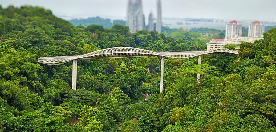
Mount Faber Park: Panoramic Views & Southern Ridges Gateway
🔵 How to Get There: Take the North East Line (NEL) or Circle Line (CCL) to HarbourFront MRT Station (NE1/CC29). From Exit D, you can access the Marang Trail, a steep but short (approx. 700m, 15-minute climb) footpath and staircase that leads directly to the top of Mount Faber Park. Alternatively, from HarbourFront, you can take a short bus ride or taxi up Mount Faber Road.
By Cable Car: A scenic way to arrive is via the Singapore Cable Car from HarbourFront Tower 2 or Sentosa. Alight at Mount Faber Peak station.
🔵 Elevation: Mount Faber Peak is 105 meters above sea level. The Marang Trail involves a significant elevation gain (equivalent to a 24-storey building).
🔵 Difficulty: The Marang Trail is moderate to strenuous due to its steepness. Faber Walk is easy. Connecting to Henderson Waves and beyond increases the overall difficulty and length of your walk.
🔵 Trail Options & Length: Mount Faber Park is a key part of the larger Southern Ridges, a 10km trail connecting several parks. Within Mount Faber itself, you can explore:
Berlayer Creek Mangrove Trail (approx. 600 m): A boardwalk through a mangrove forest, offering views of the creek.
Coastal Walk (approx. 2.2 km): Scenic paved path along the coastline with views of Keppel Harbour and Sentosa.
Fort Pasir Panjang (various paths): Explore the remnants of a World War II fort.
Dragon's Tooth Gate: Iconic rock formation marking the entrance to Keppel Harbour.
🔵 Facilities: Toilets, water fountains, shelters, a visitor centre, and historical information plaques.
🔵 Points of Interest: Coastal views, mangrove ecosystem, historical remnants of Fort Pasir Panjang with gun emplacements and tunnels, the iconic Dragon's Tooth Gate, and diverse coastal vegetation.
Telok Blangah Hill Park: Terraced Gardens and Elevated Walks
🔵 How to Get There: Take the North East Line (NEL) or Circle Line (CCL) to HarbourFront MRT Station (NE1/CC29). From Exit D, you can access the Marang Trail, a steep but short (approx. 700m, 15-minute climb) footpath and staircase that leads directly to the top of Mount Faber Park. Alternatively, from HarbourFront, you can take a short bus ride or taxi up Mount Faber Road.
By Cable Car: A scenic way to arrive is via the Singapore Cable Car from HarbourFront Tower 2 or Sentosa. Alight at Mount Faber Peak station.
🔵 Elevation: Mount Faber Peak is 105 meters above sea level. The Marang Trail involves a significant elevation gain (equivalent to a 24-storey building).
🔵 Difficulty: The Marang Trail is moderate to strenuous due to its steepness. Faber Walk is easy. Connecting to Henderson Waves and beyond increases the overall difficulty and length of your walk.
🔵 Trail Options & Length: Mount Faber Park is a key part of the larger Southern Ridges, a 10km trail connecting several parks. Within Mount Faber itself, you can explore:
Berlayer Creek Mangrove Trail (approx. 600 m): A boardwalk through a mangrove forest, offering views of the creek.
Coastal Walk (approx. 2.2 km): Scenic paved path along the coastline with views of Keppel Harbour and Sentosa.
Fort Pasir Panjang (various paths): Explore the remnants of a World War II fort.
Dragon's Tooth Gate: Iconic rock formation marking the entrance to Keppel Harbour.
🔵 Facilities: Toilets, water fountains, shelters, a visitor centre, and historical information plaques.
🔵 Points of Interest: Coastal views, mangrove ecosystem, historical remnants of Fort Pasir Panjang with gun emplacements and tunnels, the iconic Dragon's Tooth Gate, and diverse coastal vegetation.
Discovering Singapore
Your Singapore Adventure Starts Here—Plan, Explore, and Be Amazed!